|
54 |
Sunderland, Matlock Street (G4933)
|
FB |
Destroyed |
No photo
|
|
55 |
Sunderland, Roker (G4934)
|
FB |
Destroyed |
No photo
|
|
56 |
Seaburn Hall (G4935)
|
FB |
Destroyed |
No photo
|
|
57 |
Whitburn, North Guards (S8507)
|
FB |
Destroyed |
No photo
|
|
58 |
Whitburn, Mill Lane (G4936)
|
FB |
Destroyed |
No photo
|
|
59 |
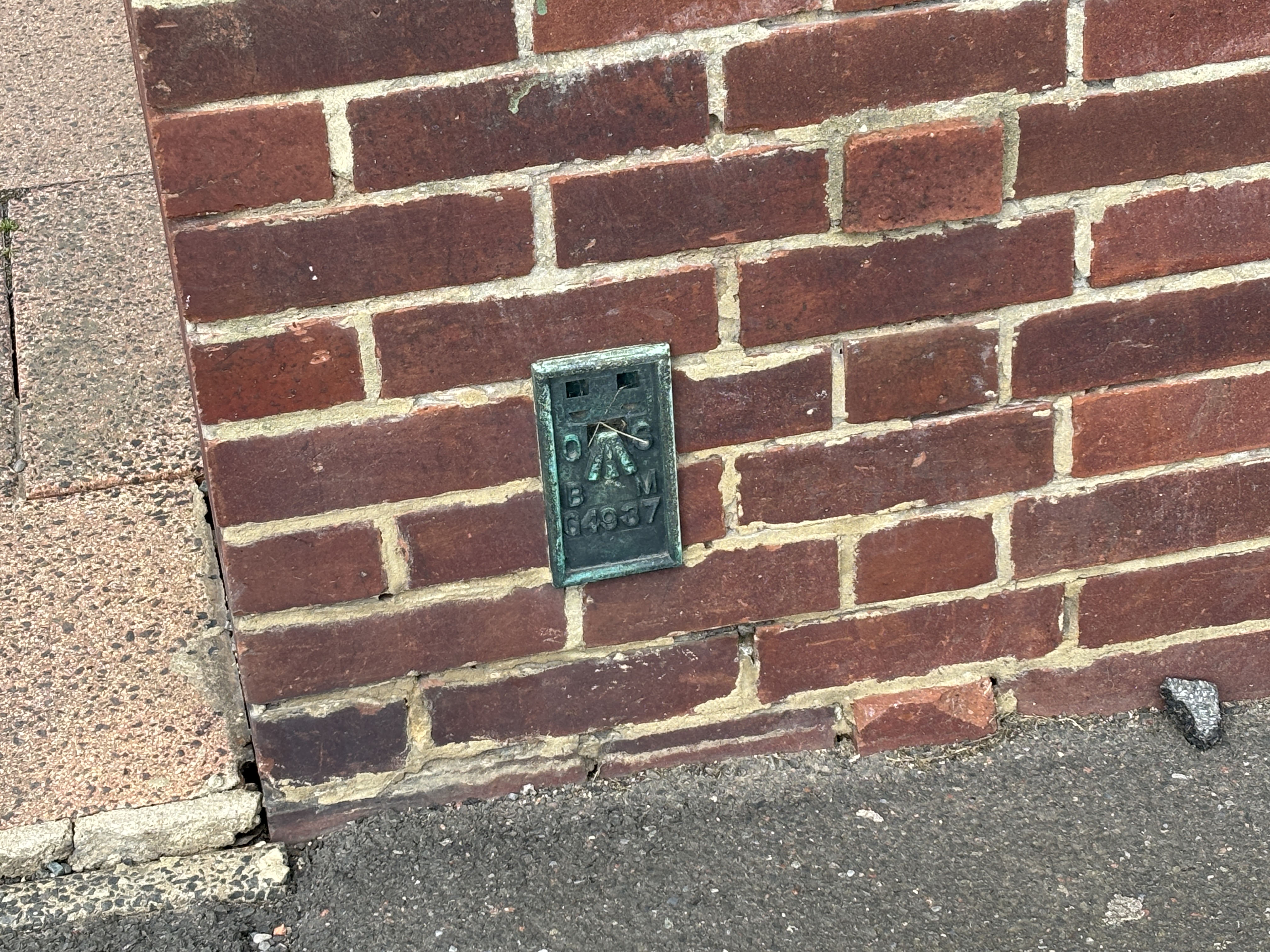
South Shields, Marsden (G4937)
|
FB |
Present |
|
|
60 |
South Shields, Bamburgh Avenue (G4938)
|
FB |
Present |
|
|
61 |
South Shields, Colliery (G4939)
|
FB |
Destroyed |
No photo
|
|
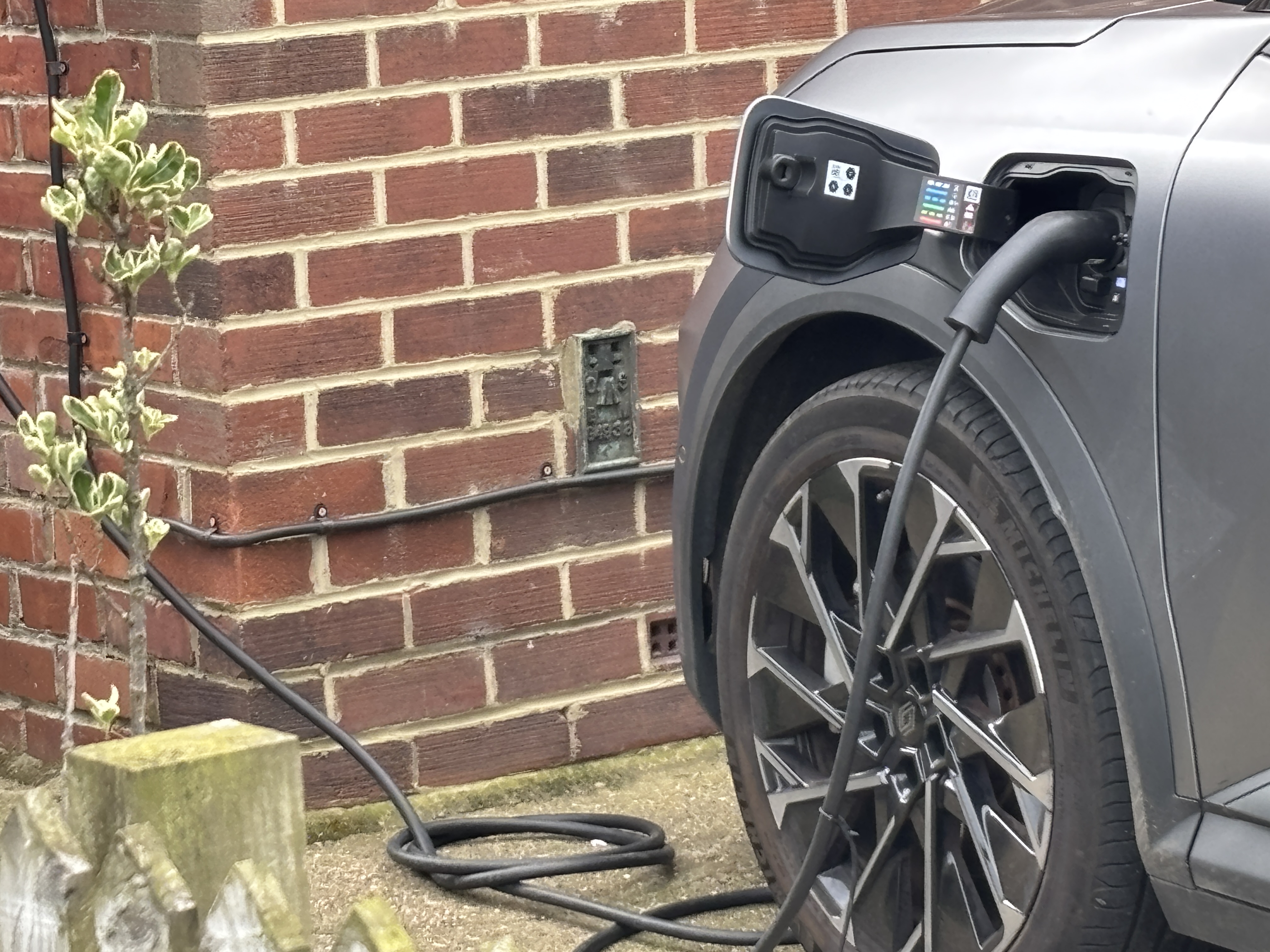
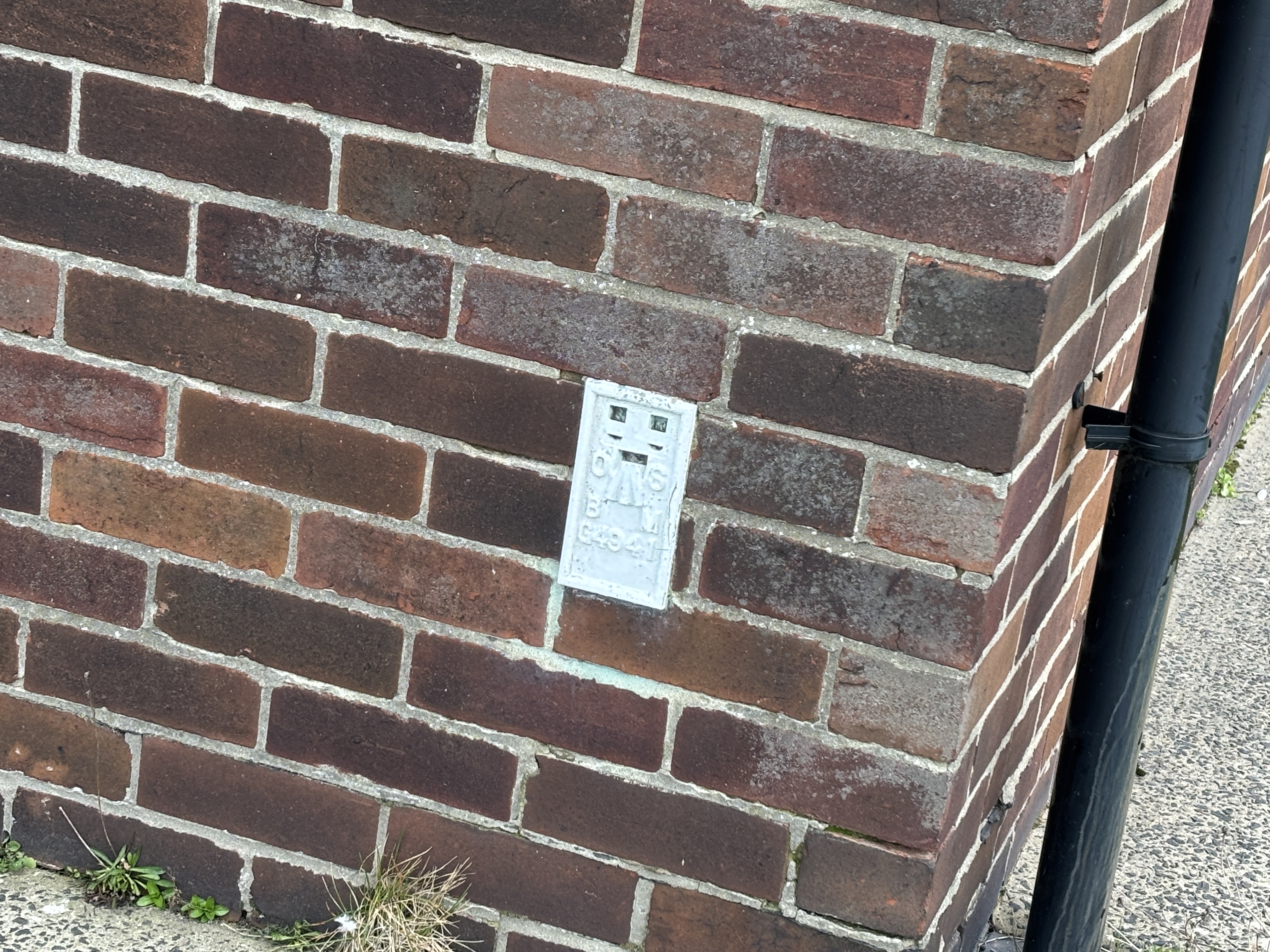
63 |
South Shields, River Drive (G4941)
|
FB |
Present |
|
|
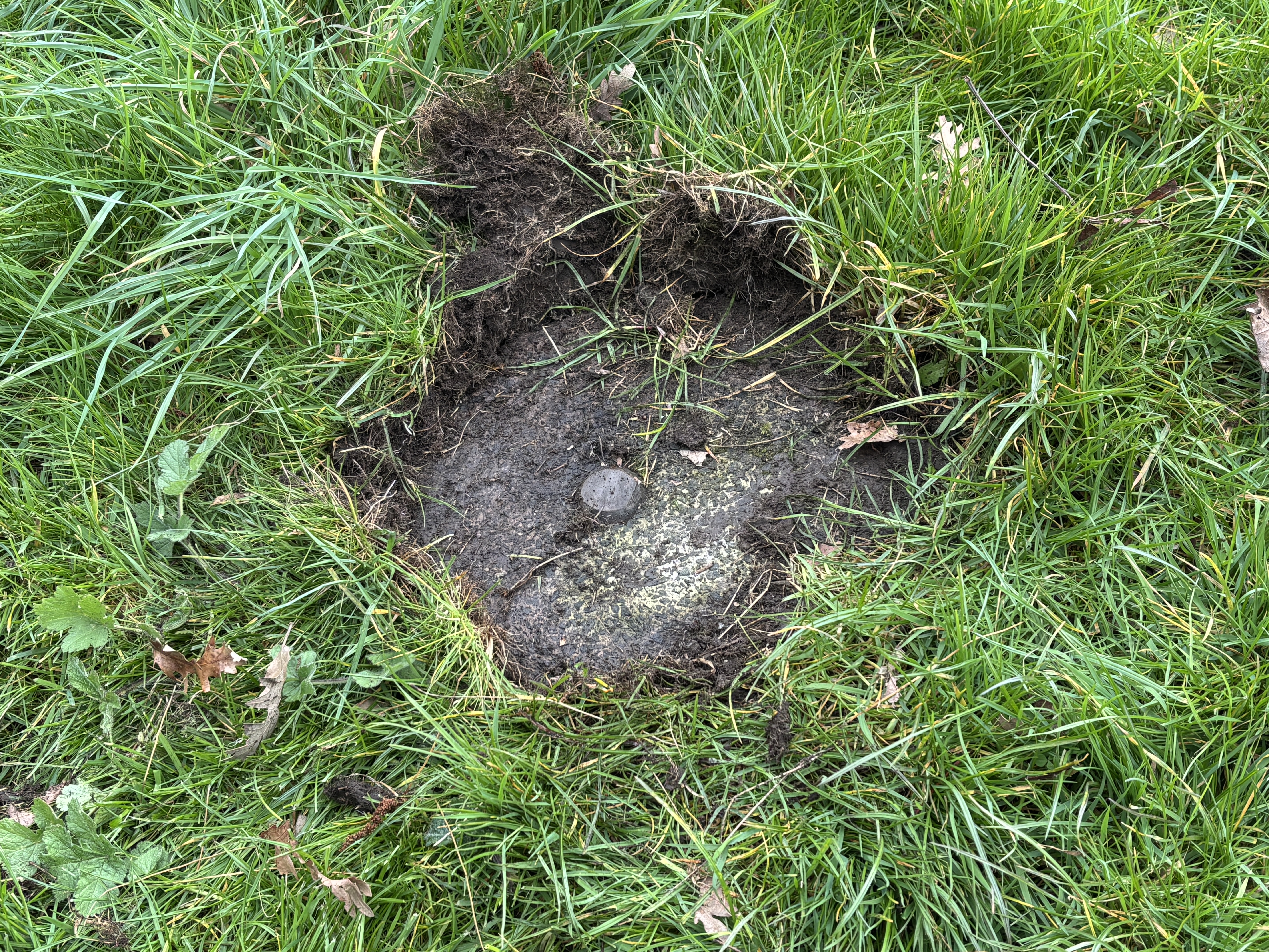
64 |
Tyne Transfer Terminal South
|
bolt |
Present |
|
|
65 |
Tyne Transfer Terminal North
|
bolt |
Destroyed |
No photo
|
|
66 |
North Shields, Ferry Mews (10888)
|
FB |
Destroyed |
No photo
|
|
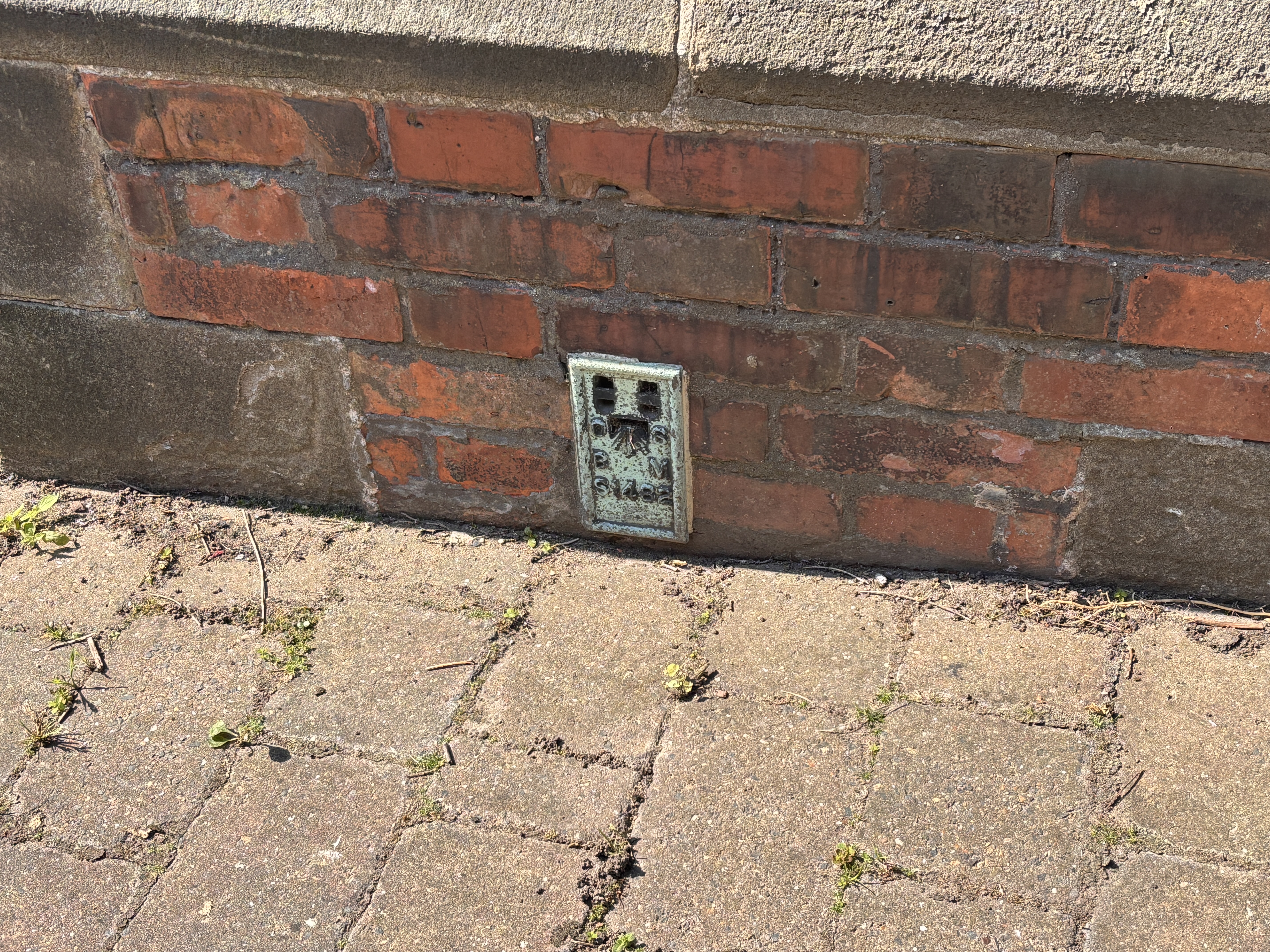
69 |
Tynemouth, R C Church (S1482)
|
FB |
Present |
|
|
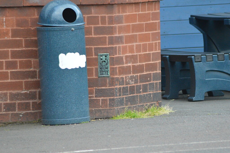
71 |
Whitley South School (S1479)
|
FB |
Present |
|
|
72 |
Whitley Bay, Windsor Terrace (S1480)
|
FB |
Destroyed |
No photo
|
|
73 |
Whitley Bay, North Lodge (10892)
|
FB |
Destroyed |
No photo
|
|
76 |
Seaton Sluice Bridge (10895)
|
FB |
Destroyed |
No photo
|
|
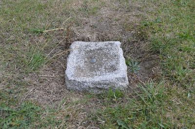
115 |
Longhorsley FBM
|
FBM |
Present |
|
